Posts Tagged 'maps'

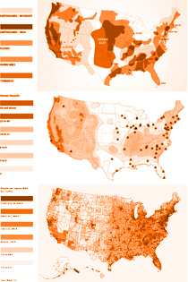
Maps: US Natural Disaster Risk, Population Density, and Nuclear Facilities
Compilation of US maps indicating Natural Disaster Risks like Earthquakes, Floods, Tornadoes, and Hurricanes, along with US Population Density breakdowns by counties (from the 2020 Census) and an up-to-date map of currently operating Nuclear Plants.